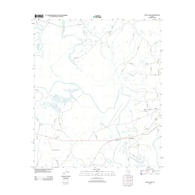
2013 Map of Long Lake
USGS Topo · Published 2013About this map
The Trinity River dominates the central corridor of this Anderson County landscape, creating an intricate network of oxbows and wetlands including Blue Lake, Big Lake, and the winding Cedar Lake Slough. The settlement of Long Lake serves as a local anchor near the river, while the presence of the Long Lake Oil Field further east signals the area's industrial importance during the early 21st century. This region is defined by its transition from fluvial bottomlands to managed lands, connected by a web of local routes like Prairie 305 and Co Rd 2803. To the northeast, the terrain is carved by Keechie Cr and Town Cr, while the southeastern corner features smaller water bodies such as Mud Lake and Little Brushy Lake. The settlement of Tucker and the historic designation of Lake Port indicate established communities thriving amidst this complex hydraulic environment.
Find a feature on this map
62 named features on this map. Tap any name to fly to it.
Don’t see what you’re looking for? This feature index may not catch every label — zoom into the map to look around manually.
Map Details
Editions of this 2013 Long Lake Map
This is the sole edition of this map. No revisions or reprints were ever made.
Other maps of this area

1949 · Palestine
USGS Topo · 1:62,500

1949 · Tennessee Colony
USGS Topo · 1:62,500

1950 · Palestine
USGS Topo · 1:62,500

1950 · Tennessee Colony
USGS Topo · 1:62,500

1951 · Elkhart
USGS Topo · 1:62,500

1953 · Palestine
USGS Topo · 1:250,000

1957 · Palestine
USGS Topo · 1:250,000

1964 · Long Lake
USGS Topo · 1:24,000

1964 · Oakwood
USGS Topo · 1:24,000

1964 · Keechi
USGS Topo · 1:24,000