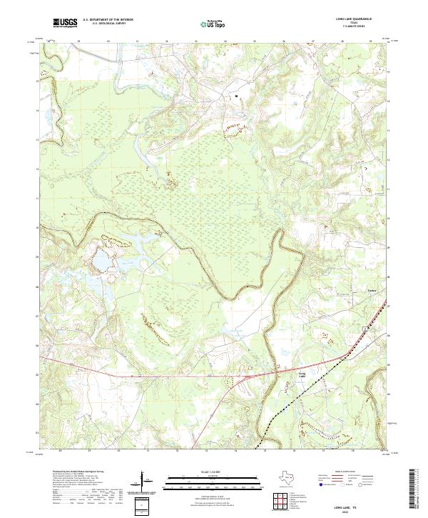
2022 Map of Long Lake
USGS Topo · Published 2022About this map
The Trinity River defines the western edge of this landscape, carving a wide floodplain shared by Anderson, Freestone, and Leon Counties. This low-lying river bottom is a labyrinth of oxbow lakes and drainage channels, including Cedar Lake, Blue Lake, and the extensive Salt Water Slough. The settlement of Long Lake sits near the namesake water body in the southern reach of the map, while Tucker occupies higher ground to the northeast. The geography here is dominated by the slow movement of water through the Keechie Cr and Caney Cr systems, creating a complex network of wetlands and seasonal sloughs. Historically, this area represents a transition between the uplands and the fertile, flood-prone bottomlands of East Texas, where transport is dictated by the passage across these numerous named lakes and creeks.
Find a feature on this map
56 named features on this map. Tap any name to fly to it.
Don’t see what you’re looking for? This feature index may not catch every label — zoom into the map to look around manually.
Map Details
Editions of this 2022 Long Lake Map
This is the sole edition of this map. No revisions or reprints were ever made.
Other maps of this area

1949 · Palestine
USGS Topo · 1:62,500

1949 · Tennessee Colony
USGS Topo · 1:62,500

1950 · Palestine
USGS Topo · 1:62,500

1950 · Tennessee Colony
USGS Topo · 1:62,500

1951 · Elkhart
USGS Topo · 1:62,500

1953 · Palestine
USGS Topo · 1:250,000

1957 · Palestine
USGS Topo · 1:250,000

1964 · Long Lake
USGS Topo · 1:24,000

1964 · Oakwood
USGS Topo · 1:24,000

1964 · Keechi
USGS Topo · 1:24,000