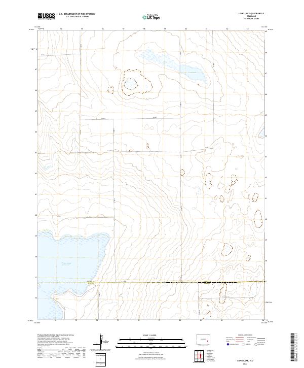
2022 Map of Long Lake
USGS Topo · Published 2022About this map
Adobe Creek Reservoir dominates the southwestern corner of this Colorado landscape, marking a significant hydrological feature on the border of Kiowa Co and Bent Co. The terrain is characterized by a sprawling network of county roads, such as Co Rd 16 and Co Rd 17, which define the rigid grid of the Public Land Survey System across Township 19 South and Township 20 South. In the northern reaches, the dual basins of Long Lake appear as distinct water bodies amidst the subtle elevation changes of the high plains. This map captures the intersection of critical water management and the expansive agricultural or grazing allotments that rely on the thoroughfare of routes like Co Rd WW and Co Rd F to navigate the open country.
Find a feature on this map
21 named features on this map. Tap any name to fly to it.
Don’t see what you’re looking for? This feature index may not catch every label — zoom into the map to look around manually.
Map Details
Editions of this 2022 Long Lake Map
This is the sole edition of this map. No revisions or reprints were ever made.
Other maps of this area

1891 · Las Animas
USGS Topo · 1:125,000

1893 · Las Animas
USGS Topo · 1:125,000

1954 · Lamar
USGS Topo · 1:250,000

1955 · Tree Top Ranch
USGS Topo · 1:24,000

1955 · Mc Intosh Ranch
USGS Topo · 1:24,000

1955 · Bishop Ranch
USGS Topo · 1:24,000

1958 · Lamar
USGS Topo · 1:250,000

1974 · Haswell
USGS Topo · 1:24,000
1974 · Haswell SE
USGS Topo · 1:24,000

1974 · Arlington NE
USGS Topo · 1:24,000