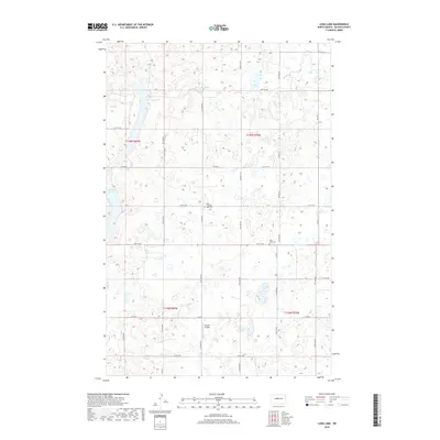
2018 Map of Long Lake
USGS Topo · Published 2018About this map
Glacial prairie potholes and scattered wetlands define this section of McLean County, where the landscape is etched by a rigid grid of section-line roads and family-named cemeteries. The topography is dominated by the elongated basins of Long Lake and Crooked Lake, which serve as primary landmarks in an otherwise agrarian expanse. Local history is anchored by the Saint Johns Cem and East Crooked Lake Cem, markers of early settlement patterns near the intersections of Co Hwy 6 and various county routes. A modern layer is added by the Cloud 9 Airport, positioned along Co RD 6, illustrating the continued utility of the land for local aviation. The map reveals the intricate network of numbered thoroughfares, such as 18th St NW and 13th Ave NW, which organize the rural townships and connect remote farmsteads across the North Dakota plains.
Find a feature on this map
28 named features on this map. Tap any name to fly to it.
Don’t see what you’re looking for? This feature index may not catch every label — zoom into the map to look around manually.
Map Details
Editions of this 2018 Long Lake Map
This is the sole edition of this map. No revisions or reprints were ever made.
Other maps of this area

1929 · Kongsberg
USGS Topo · 1:62,500

1929 · Balfour
USGS Topo · 1:62,500

1945 · Pelican Lake
USGS Topo · 1:62,500

1947 · Pelican Lake
USGS Topo · 1:62,500

1947 · Turtle Lake
USGS Topo · 1:62,500

1954 · McClusky
USGS Topo · 1:250,000

1958 · McClusky
USGS Topo · 1:250,000

1958 · Butte
USGS Topo · 1:24,000

1958 · Balfour
USGS Topo · 1:62,500

1961 · Turtle Lake
USGS Topo · 1:24,000