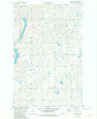
1981 Map of Long Lake
USGS Topo · Published 1982About this map
Horseshoe Valley and the surrounding prairie of McLean County are defined by a complex network of glacial potholes and seasonal wetlands, as seen in this early 1980s topographic study. The landscape is dominated by Long Lake and Crooked Lake, with significant portions of the terrain dedicated to conservation through the Camp Lake National Wildlife Refuge and the National Waterfowl Production Area. These protected spaces highlight the region's importance for migratory birds within the Great Plains flyway.
Find a feature on this map
14 named features on this map. Tap any name to fly to it.
Don’t see what you’re looking for? This feature index may not catch every label — zoom into the map to look around manually.
Map Details
Editions of this 1981 Long Lake Map
This is the sole edition of this map. No revisions or reprints were ever made.
Other maps of this area

1929 · Kongsberg
USGS Topo · 1:62,500

1929 · Balfour
USGS Topo · 1:62,500

1945 · Pelican Lake
USGS Topo · 1:62,500

1947 · Pelican Lake
USGS Topo · 1:62,500

1947 · Turtle Lake
USGS Topo · 1:62,500

1954 · McClusky
USGS Topo · 1:250,000

1958 · McClusky
USGS Topo · 1:250,000

1958 · Butte
USGS Topo · 1:24,000

1958 · Balfour
USGS Topo · 1:62,500

1961 · Turtle Lake
USGS Topo · 1:24,000