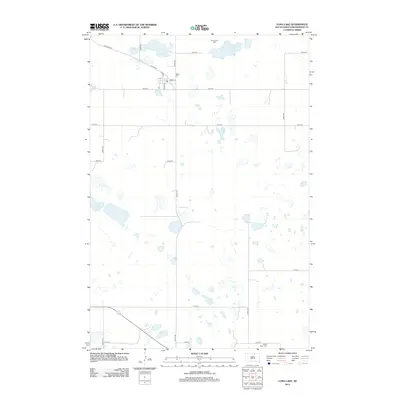
2012 Map of Long Lake
USGS Topo · Published 2012About this map
The small community of Long Lake is the focal point of this McPherson County landscape, situated where Old Sioux Rd transitions into a grid of local streets including Main St, Penn St, and McCoy St. This 2012 survey illustrates a classic northern plains settlement pattern, with the town surrounded by a vast network of section-line roads such as 350th Ave and 106th St. The area is dotted with numerous small prairie potholes and larger water bodies like Klooz Lake.
Find a feature on this map
22 named features on this map. Tap any name to fly to it.
Don’t see what you’re looking for? This feature index may not catch every label — zoom into the map to look around manually.
Map Details
Editions of this 2012 Long Lake Map
This is the sole edition of this map. No revisions or reprints were ever made.
Other maps of this area

1954 · Aberdeen
USGS Topo · 1:250,000

1956 · Aberdeen
USGS Topo · 1:250,000

1968 · Long Lake
USGS Topo · 1:24,000

1968 · Long Lake SE
USGS Topo · 1:24,000

1968 · Long Lake NW
USGS Topo · 1:24,000

1968 · Long Lake NE
USGS Topo · 1:24,000

1978 · Hosmer NE
USGS Topo · 1:24,000
1978 · Plainview Colony NE
USGS Topo · 1:24,000

1978 · Schumacher Lake
USGS Topo · 1:24,000

1978 · Plainview Colony NW
USGS Topo · 1:24,000