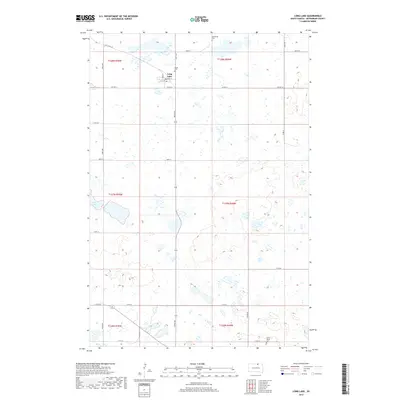
2017 Map of Long Lake
USGS Topo · Published 2017About this map
The small town of Long Lake serves as the focal point for this survey of McPherson County's glaciated prairie landscape. Established near its namesake water body, the community is defined by its rectilinear grid of streets including Main St and Penn St. The surrounding countryside is dotted with Numerous small wetlands and depressions characteristic of the Missouri Coteau region, including the larger Klooz Lake to the southwest.
Find a feature on this map
29 named features on this map. Tap any name to fly to it.
Don’t see what you’re looking for? This feature index may not catch every label — zoom into the map to look around manually.
Map Details
Editions of this 2017 Long Lake Map
This is the sole edition of this map. No revisions or reprints were ever made.
Other maps of this area

1954 · Aberdeen
USGS Topo · 1:250,000

1956 · Aberdeen
USGS Topo · 1:250,000

1968 · Long Lake
USGS Topo · 1:24,000

1968 · Long Lake SE
USGS Topo · 1:24,000

1968 · Long Lake NW
USGS Topo · 1:24,000

1968 · Long Lake NE
USGS Topo · 1:24,000

1978 · Hosmer NE
USGS Topo · 1:24,000
1978 · Plainview Colony NE
USGS Topo · 1:24,000

1978 · Schumacher Lake
USGS Topo · 1:24,000

1978 · Plainview Colony NW
USGS Topo · 1:24,000