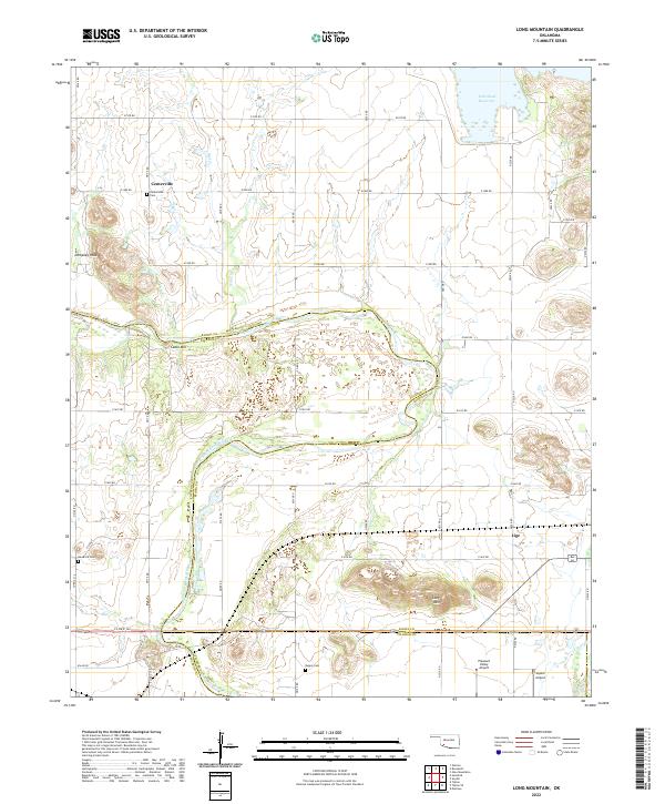
2022 Map of Long Mountain
USGS Topo · Published 2022About this map
The North Fork Red River forms a major geographical boundary through this southwestern Oklahoma landscape, separating Kiowa and Jackson Counties. The terrain is defined by isolated peaks such as Dempsey Peak, Cable Mtn, and Long Mtn, which rise sharply from the surrounding plains. To the northeast, the Tom Steed Reservoir dominates the drainage patterns of the area, while the southern reaches are marked by the presence of Otter Cr.
Find a feature on this map
33 named features on this map. Tap any name to fly to it.
Don’t see what you’re looking for? This feature index may not catch every label — zoom into the map to look around manually.
Map Details
Editions of this 2022 Long Mountain Map
This is the sole edition of this map. No revisions or reprints were ever made.
Other maps of this area

1949 · Cooperton
USGS Topo · 1:62,500

1950 · Snyder
USGS Topo · 1:62,500

1955 · Lawton
USGS Topo · 1:250,000

1956 · Glen Mountains
USGS Topo · 1:24,000

1956 · Manitou
USGS Topo · 1:24,000

1956 · Snyder
USGS Topo · 1:24,000

1956 · Snyder
USGS Topo · 1:62,500

1956 · Cooperton
USGS Topo · 1:62,500

1964 · Tipton SE
USGS Topo · 1:24,000

1964 · Tipton
USGS Topo · 1:24,000