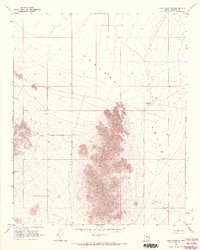
1968 Map of Long Mountain
USGS Topo · Published 1971About this map
Long Mountain dominates the central landscape of this Mohave County region, standing as a prominent geological feature above the surrounding Hualapai Valley. The map, based on late 1960s aerial photography, documents a remote area where human presence is defined by ranching infrastructure and water management. Evidence of local habitation and land use is centered around the Dutton Ranch, supported by small-scale water sources such as Foo Tank and the Hualapai Reservoir. The network of travel is sparse, consisting primarily of a Jeep Trail cutting across the desert floor. This survey captures a specific moment in the arid Arizona interior, highlighting the isolation of mountain ranges within the valley system and the precise locations of essential desert wells and water tanks that allowed for ranching in this environment.
Find a feature on this map
9 named features on this map. Tap any name to fly to it.
Don’t see what you’re looking for? This feature index may not catch every label — zoom into the map to look around manually.
Map Details
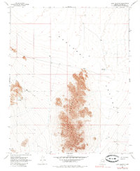
Editions of this 1968 Long Mountain Map
2 editions found
Other maps of this area

1886 · Diamond Creek
USGS Topo · 1:250,000

1886 · Camp Mohave
USGS Topo · 1:250,000

1892 · Diamond Creek
USGS Topo · 1:250,000

1892 · Camp Mohave
USGS Topo · 1:250,000

1939 · Chloride
USGS Topo · 1:48,000

1942 · Camp Mohave
USGS Topo · 1:250,000

1944 · Chloride
USGS Topo · 1:62,500

1947 · Kingman
USGS Topo · 1:250,000

1948 · Kingman
USGS Topo · 1:250,000

1948 · Williams
USGS Topo · 1:250,000