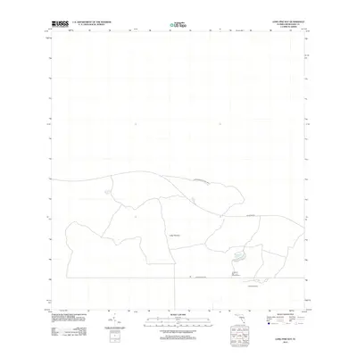
2012 Map of Long Pine Key
USGS Topo · Published 2012About this map
Everglades National Park covers the majority of this landscape in Miami-Dade County, characterized by the unique limestone ridge of Long Pine Key. This elevated pine rockland habitat is traversed by Main Park Rd and Long Pine Key Rd, which provide access to the interior wilderness. The map documents critical infrastructure for park management and visitors, including the Long Pine Key Lookout Tower and Camp Everglades. This 2012 survey illustrates the network of access roads and protected areas within the subtropical ecosystem before modern environmental shifts, serving as a record of the park's administrative and recreational layout during the early 21st century.
Find a feature on this map
7 named features on this map. Tap any name to fly to it.
Don’t see what you’re looking for? This feature index may not catch every label — zoom into the map to look around manually.
Map Details
Editions of this 2012 Long Pine Key Map
This is the sole edition of this map. No revisions or reprints were ever made.
Other maps of this area

1956 · Grossman Hammock
USGS Topo · 1:24,000

1956 · Royal Palm Ranger Station
USGS Topo · 1:24,000

1956 · Royal Palm Ranger Station SE
USGS Topo · 1:24,000

1956 · Miami
USGS Topo · 1:250,000

1958 · Miami
USGS Topo · 1:250,000

1967 · Royal Palm Ranger Station SE
USGS Topo · 1:24,000

1972 · Mahogany Hammock
USGS Topo · 1:24,000

1972 · Taylor Slough
USGS Topo · 1:24,000

1972 · Long Pine Key
USGS Topo · 1:24,000

1972 · Panther Mound
USGS Topo · 1:24,000