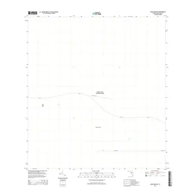
2015 Map of Long Pine Key
USGS Topo · Published 2015About this map
Everglades National Park dominates this south Florida landscape, showcasing the preservation of the unique subtropical ecosystem within Miami-Dade County. The map details the transition between the higher ground of Long Pine Key and the surrounding marshland, specifically highlighting Rock Reef Pass where the limestone bedrock influences the local topography. This 2015 data illustrates the managed infrastructure within the park, including the path of SR-9336 as it winds through the pinelands and provides access to research and recreational corridors. Footpaths like the Pinelands Trl and specialized thoroughfares such as Research Rd indicate the area's dual role as a site for public exploration and scientific study of this specific wetland environment.
Find a feature on this map
6 named features on this map. Tap any name to fly to it.
Don’t see what you’re looking for? This feature index may not catch every label — zoom into the map to look around manually.
Map Details
Editions of this 2015 Long Pine Key Map
This is the sole edition of this map. No revisions or reprints were ever made.
Other maps of this area

1956 · Grossman Hammock
USGS Topo · 1:24,000

1956 · Royal Palm Ranger Station
USGS Topo · 1:24,000

1956 · Royal Palm Ranger Station SE
USGS Topo · 1:24,000

1956 · Miami
USGS Topo · 1:250,000

1958 · Miami
USGS Topo · 1:250,000

1967 · Royal Palm Ranger Station SE
USGS Topo · 1:24,000

1972 · Mahogany Hammock
USGS Topo · 1:24,000

1972 · Taylor Slough
USGS Topo · 1:24,000

1972 · Long Pine Key
USGS Topo · 1:24,000

1972 · Panther Mound
USGS Topo · 1:24,000