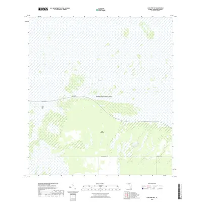
2018 Map of Long Pine Key
USGS Topo · Published 2018About this map
Everglades National Park covers the vast majority of this landscape, showcasing the intricate wetland environment of South Florida during the early twenty-first century. The map highlights the sprawling reaches of the Everglades, where the low-lying terrain is punctuated by significant features like Long Pine Key, an island of higher ground amidst the surrounding marsh. Modern access is represented by Main Park Rd, which winds through the northern portion of the quadrangle, and Long Pine Key Rd further south. This survey provides a distinct record of the hydrology and natural boundaries in the region, including the location of Rock Reef Pass, which serves as a natural transition point within the water-dominant topography of Miami-Dade County.
Find a feature on this map
6 named features on this map. Tap any name to fly to it.
Don’t see what you’re looking for? This feature index may not catch every label — zoom into the map to look around manually.
Map Details
Editions of this 2018 Long Pine Key Map
This is the sole edition of this map. No revisions or reprints were ever made.
Other maps of this area

1956 · Grossman Hammock
USGS Topo · 1:24,000

1956 · Royal Palm Ranger Station
USGS Topo · 1:24,000

1956 · Royal Palm Ranger Station SE
USGS Topo · 1:24,000

1956 · Miami
USGS Topo · 1:250,000

1958 · Miami
USGS Topo · 1:250,000

1967 · Royal Palm Ranger Station SE
USGS Topo · 1:24,000

1972 · Mahogany Hammock
USGS Topo · 1:24,000

1972 · Taylor Slough
USGS Topo · 1:24,000

1972 · Long Pine Key
USGS Topo · 1:24,000

1972 · Panther Mound
USGS Topo · 1:24,000