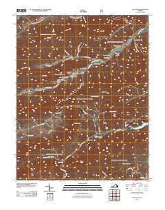
2011 Map of Long Spur
USGS Topo · Published 2011About this map
Cove Mountain and Brushy Ridge dominate this section of Pulaski County, where the landscape is defined by a dense network of hollows and ridges. The 2011 topography reveals a rural settlement pattern established along the watercourses, particularly Little Walker Creek and Peak Creek. Genealogists may find interest in the documented locations of Goshen Cemetery and Hidden Valley Cemetery, which are tucked away in the shadows of the surrounding peaks like High Rock and Round Mountain.
Find a feature on this map
50 named features on this map. Tap any name to fly to it.
Don’t see what you’re looking for? This feature index may not catch every label — zoom into the map to look around manually.
Map Details
Editions of this 2011 Long Spur Map
This is the sole edition of this map. No revisions or reprints were ever made.
Other maps of this area

1887 · Pocahontas
USGS Topo · 1:125,000

1889 · Hillsville
USGS Topo · 1:125,000

1889 · Wytheville
USGS Topo · 1:125,000

1890 · Dublin
USGS Topo · 1:125,000

1891 · Pocahontas
USGS Topo · 1:125,000

1891 · Dublin
USGS Topo · 1:125,000

1892 · Hillsville
USGS Topo · 1:125,000

1892 · Wytheville
USGS Topo · 1:125,000

1894 · Pocahontas
USGS Topo · 1:125,000

1895 · Pocahontas
USGS Topo · 1:125,000