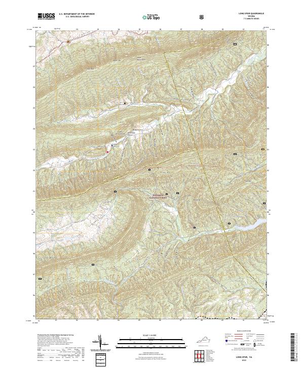
2022 Map of Long Spur
USGS Topo · Published 2022About this map
Walker Mtn and Little Walker Mtn dominate the northern landscape of this Virginia terrain, where the boundaries of Wythe, Bland, and Pulaski counties converge. The area is defined by a series of parallel ridges and deep hollows, including the prominent Long Spur and Brushy Ridge. Genealogical interest is centered on small, remote sites like Goshen Cem near Spur Br and Hidden Valley Cem tucked into the southern shadows of Walker Mtn. This region of the Jefferson National Forest shows a pattern of limited development concentrated along watercourses such as Little Walker Creek and Peak Creek. The presence of numerous named hollows—including Bridge Hollow, Davis Gate Hollow, and Sulphur Spring Hollow—suggests a history of isolated family settlements and localized water sources that defined life in these Appalachian folds long before modern road networks like the Little Creek Hwy were established.
Find a feature on this map
59 named features on this map. Tap any name to fly to it.
Don’t see what you’re looking for? This feature index may not catch every label — zoom into the map to look around manually.
Map Details
Editions of this 2022 Long Spur Map
This is the sole edition of this map. No revisions or reprints were ever made.
Other maps of this area

1887 · Pocahontas
USGS Topo · 1:125,000

1889 · Hillsville
USGS Topo · 1:125,000

1889 · Wytheville
USGS Topo · 1:125,000

1890 · Dublin
USGS Topo · 1:125,000

1891 · Pocahontas
USGS Topo · 1:125,000

1891 · Dublin
USGS Topo · 1:125,000

1892 · Hillsville
USGS Topo · 1:125,000

1892 · Wytheville
USGS Topo · 1:125,000

1894 · Pocahontas
USGS Topo · 1:125,000

1895 · Pocahontas
USGS Topo · 1:125,000