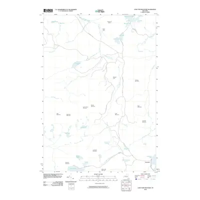
2010 Map of Long Tom Mountain
USGS Topo · Published 2010About this map
Adirondack Park lands dominate this part of Saint Lawrence County, where the South Branch Grass River winds through a dense network of high peaks and isolated water bodies. The terrain is defined by a series of named summits, including Long Tom Mountain, Wheeler Mountain, and Buck Mountain, which overlook a complex hydrography of ponds and flows. To the north, the Massawe pie Lake and the smaller Boottree Pond are accessible via Massawe pie Rd, while the southern reaches features the larger Horseshoe Lake. The distribution of features like Burntbridge Pond and its Burntbridge Outlet illustrate a landscape largely untouched by modern development, characterized instead by natural landmarks such as Douglas Rock and Hardwood Island. This area serves as a primary example of the high-elevation wilderness found in the northern Adirondacks, preserving the same nomenclature and drainage patterns documented by earlier generations of surveyors.
Find a feature on this map
41 named features on this map. Tap any name to fly to it.
Don’t see what you’re looking for? This feature index may not catch every label — zoom into the map to look around manually.
Map Details
Editions of this 2010 Long Tom Mountain Map
This is the sole edition of this map. No revisions or reprints were ever made.
Other maps of this area

1907 · Tupper Lake
USGS Topo · 1:62,500

1919 · Cranberry Lake
USGS Topo · 1:62,500

1920 · Childwold
USGS Topo · 1:62,500

1921 · Cranberry Lake
USGS Topo · 1:62,500

1921 · Childwold
USGS Topo · 1:48,000

1921 · Stark
USGS Topo · 1:62,500

1922 · Childwold
USGS Topo · 1:62,500

1923 · Stark
USGS Topo · 1:62,500

1931 · Cranberry Lake
USGS Topo · 1:62,500

1940 · Stark
USGS Topo · 1:62,500