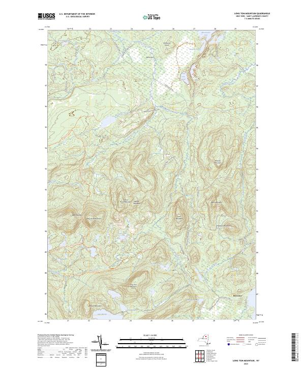
2023 Map of Long Tom Mountain
USGS Topo · Published 2023About this map
Adirondack Park Preserve defines the landscape of this region, where a dense network of water and peaks creates a complex wilderness topography. The South Branch Grass River winds through the center of the sheet, feeding into the Grass River Flow at the northern boundary. Dozens of isolated water bodies, including Sardine Pond, Boottree Pond, and the expansive Massawepie Lake, are tucked between prominent elevations like Bear Mountain, Haystack Mountain, and the namesake Long Tom Mountain.
Find a feature on this map
44 named features on this map. Tap any name to fly to it.
Don’t see what you’re looking for? This feature index may not catch every label — zoom into the map to look around manually.
Map Details
Editions of this 2023 Long Tom Mountain Map
This is the sole edition of this map. No revisions or reprints were ever made.
Other maps of this area

1907 · Tupper Lake
USGS Topo · 1:62,500

1919 · Cranberry Lake
USGS Topo · 1:62,500

1920 · Childwold
USGS Topo · 1:62,500

1921 · Cranberry Lake
USGS Topo · 1:62,500

1921 · Childwold
USGS Topo · 1:48,000

1921 · Stark
USGS Topo · 1:62,500

1922 · Childwold
USGS Topo · 1:62,500

1923 · Stark
USGS Topo · 1:62,500

1931 · Cranberry Lake
USGS Topo · 1:62,500

1940 · Stark
USGS Topo · 1:62,500