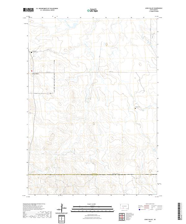
2021 Map of Long Valley
USGS Topo · Published 2021About this map
Long Valley anchors this western South Dakota landscape where the high plains of Jackson County meet the northern border of Bennett County. The settlement is positioned along the northwestern edge of the sheet, served by the Community Cem nearby. The terrain is defined by a dendritic network of drainage creeks, including Pass Cr, Buzzard Cr, and Settin Up Cr, which carve through the undulating topography typical of the region's ranching country.
Find a feature on this map
25 named features on this map. Tap any name to fly to it.
Don’t see what you’re looking for? This feature index may not catch every label — zoom into the map to look around manually.
Map Details
Editions of this 2021 Long Valley Map
This is the sole edition of this map. No revisions or reprints were ever made.
Other maps of this area

1955 · Martin
USGS Topo · 1:250,000

1958 · Martin
USGS Topo · 1:250,000

1980 · Kadoka
USGS Topo · 1:100,000

1981 · Long Valley
USGS Topo · 1:25,000

1981 · Patricia
USGS Topo · 1:25,000

1981 · Broken Leg Dam
USGS Topo · 1:24,000

1981 · Blackpipe
USGS Topo · 1:25,000
1981 · Short Bow Creek
USGS Topo · 1:25,000
1981 · Buzzard Butte
USGS Topo · 1:25,000

1983 · Martin
USGS Topo · 1:100,000