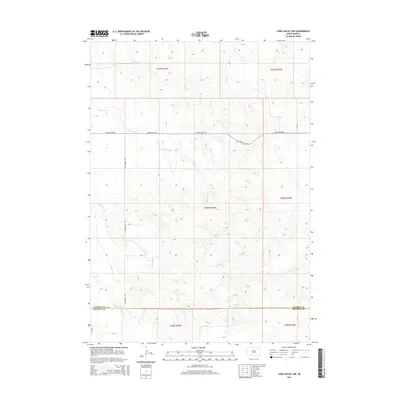
2015 Map of Long Valley NW
USGS Topo · Published 2015About this map
The boundary between Jackson and Bennett Counties bisects this South Dakota landscape, which is defined by a series of north-flowing intermittent drainages. The area is dominated by the catchments of Lost Turkey Creek and Waterhole Creek, which reveal a terrain shaped by gradual erosion and seasonal water flow. Transport is restricted to a grid of rural routes including Long Valley Road and Wanamaker Road, which follow the section lines of the Public Land Survey System. The map documents the vast, open character of the Great Plains in the early 21st century, where the network of named creeks like Fish Creek, Corn Creek, and Dry Creek provided the essential structure for land division and early ranching boundaries in this part of the state.
Find a feature on this map
17 named features on this map. Tap any name to fly to it.
Don’t see what you’re looking for? This feature index may not catch every label — zoom into the map to look around manually.
Map Details
Editions of this 2015 Long Valley NW Map
This is the sole edition of this map. No revisions or reprints were ever made.
Other maps of this area

1955 · Martin
USGS Topo · 1:250,000

1958 · Martin
USGS Topo · 1:250,000

1969 · Norris
USGS Topo · 1:24,000

1969 · Eagle Mans Butte
USGS Topo · 1:24,000

1980 · Kadoka
USGS Topo · 1:100,000

1981 · Cedar Butte
USGS Topo · 1:25,000

1981 · Long Valley
USGS Topo · 1:25,000

1981 · Blackpipe
USGS Topo · 1:25,000
1981 · Short Bow Creek
USGS Topo · 1:25,000

1983 · Martin
USGS Topo · 1:100,000