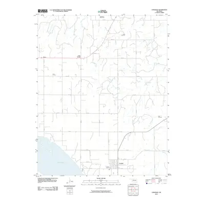
2010 Map of Longdale
USGS Topo · Published 2010About this map
The town of Longdale sits at the southern edge of this Oklahoma landscape, overlooking the northeastern shoreline of Canton Lake. This 2010 survey illustrates a rural grid dominated by section roads and small-scale agriculture, with the community of Cedar Springs and the locality of Dane serving as secondary points of interest. The terrain is defined by a dendritic drainage pattern where Cottonwood Creek, Skunk Creek, and the long winding course of Sand Creek cut through the plains.
Find a feature on this map
34 named features on this map. Tap any name to fly to it.
Don’t see what you’re looking for? This feature index may not catch every label — zoom into the map to look around manually.
Map Details
Editions of this 2010 Longdale Map
This is the sole edition of this map. No revisions or reprints were ever made.
Other maps of this area

1955 · Woodward
USGS Topo · 1:250,000

1958 · Woodward
USGS Topo · 1:250,000

1969 · Glass Mountains
USGS Topo · 1:24,000

1969 · Fairview
USGS Topo · 1:24,000

1969 · Glass Mountains SW
USGS Topo · 1:24,000

1972 · Longdale
USGS Topo · 1:24,000

1972 · Canton NW
USGS Topo · 1:24,000

1972 · Canton
USGS Topo · 1:24,000

1972 · Canton SW
USGS Topo · 1:24,000

1972 · Southard
USGS Topo · 1:24,000