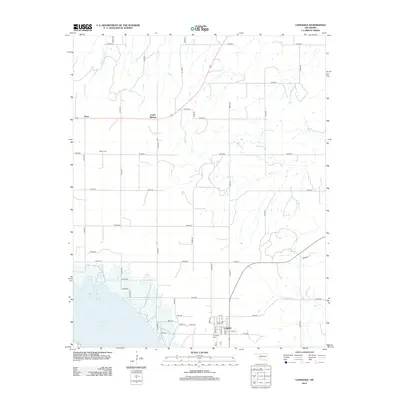
2012 Map of Longdale
USGS Topo · Published 2012About this map
Canton Lake dominates the southwestern corner of this Oklahoma landscape, its northern shoreline defining the boundary between the water and the structured grid of rural Blaine County. The settlement of Longdale sits just inland from the lake, organized around a compact street plan including Maple St and 1st St, with the Longdale Cem located on its southern edge. This 2012 survey illustrates the transition from the lakeside environment to the agricultural interior, where the land is carved by several drainages, notably Sand Cr, Skunk Cr, and Cottonwood Cr. Smaller communities and junctions like Cedar Springs and Dane punctuate the northern sections, connected by a network of sectional roads such as E 2490 RD. The presence of Bethel Cem in the western reaches provides a specific point of interest for those tracing family history in this corner of the state.
Find a feature on this map
45 named features on this map. Tap any name to fly to it.
Don’t see what you’re looking for? This feature index may not catch every label — zoom into the map to look around manually.
Map Details
Editions of this 2012 Longdale Map
This is the sole edition of this map. No revisions or reprints were ever made.
Other maps of this area

1955 · Woodward
USGS Topo · 1:250,000

1958 · Woodward
USGS Topo · 1:250,000

1969 · Glass Mountains
USGS Topo · 1:24,000

1969 · Fairview
USGS Topo · 1:24,000

1969 · Glass Mountains SW
USGS Topo · 1:24,000

1972 · Longdale
USGS Topo · 1:24,000

1972 · Canton NW
USGS Topo · 1:24,000

1972 · Canton
USGS Topo · 1:24,000

1972 · Canton SW
USGS Topo · 1:24,000

1972 · Southard
USGS Topo · 1:24,000