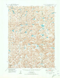
1950 Map of Longfellow Lake
USGS Topo · Published 1950About this map
Longfellow Lake and a dense network of water bodies anchor this western Nebraska landscape, where the sand hills are defined by a complex series of family-named valleys. Settlements are sparse, represented by a system of rural educational outposts including School No 22, School No 18, and School No 32. The southwestern corner of the quadrangle is occupied by the Crescent Lake National Wildlife Refuge, marking a significant conservation footprint in Garden County. The naming conventions of the terrain, such as Scheffenburg Valley, Warneke Valley, and Festerman Valley, suggest a history of early 20th-century homesteading and ranching families who worked this land before 1950. Distinctive features like Dipping Vat Lake point to the area's cattle-raising heritage, while the prevalence of windmills across the valleys highlights the constant need for groundwater management in this environment.
Find a feature on this map
58 named features on this map. Tap any name to fly to it.
Don’t see what you’re looking for? This feature index may not catch every label — zoom into the map to look around manually.
Map Details
Editions of this 1950 Longfellow Lake Map
3 editions found

Other maps of this area

1948 · Ashby
USGS Topo · 1:62,500

1948 · Bingham
USGS Topo · 1:62,500

1948 · Lakeside
USGS Topo · 1:62,500

1948 · George Lake
USGS Topo · 1:62,500

1949 · Ashby
USGS Topo · 1:62,500

1949 · Mumper
USGS Topo · 1:62,500

1949 · Rackett
USGS Topo · 1:62,500

1950 · Velma
USGS Topo · 1:62,500

1950 · Crescent Lake
USGS Topo · 1:62,500

1950 · George Lake
USGS Topo · 1:62,500