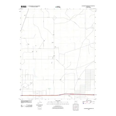
2010 Map of Longhorn Reservoir
USGS Topo · Published 2010About this map
The Longhorn Reservoir and its surrounding ranchlands characterize this high plains landscape in Santa Fe County during the early 21st century. The map reveals a transition from traditional large-scale cattle operations to emerging residential developments, particularly south of the interstate corridor near E Abrahames Rd and Frontage Rd. Established family holdings like Rowell Ranch, Healy Ranch, and Erramousbe Ranch define the vast northern reaches, often organized around seasonal water features such as Salt Draw and Armijo Draw. The geometry of the road network, including County Rd-128 and Anaya Rd, highlights the enduring importance of these ranching access points, even as a dense grid of newer streets like Percheron St and Belgian Ave suggests a shift toward rural-residential subdivisions near the southern edge of the quadrangle.
Find a feature on this map
41 named features on this map. Tap any name to fly to it.
Don’t see what you’re looking for? This feature index may not catch every label — zoom into the map to look around manually.
Map Details
Editions of this 2010 Longhorn Reservoir Map
This is the sole edition of this map. No revisions or reprints were ever made.
Other maps of this area

1892 · San Pedro
USGS Topo · 1:125,000

1894 · Lamy
USGS Topo · 1:125,000

1917 · Estancia
USGS Topo · 1:125,000

1954 · Santa Fe
USGS Topo · 1:250,000

1954 · Fort Sumner
USGS Topo · 1:250,000

1954 · Socorro
USGS Topo · 1:250,000

1956 · Edgewood
USGS Topo · 1:62,500

1956 · Estancia
USGS Topo · 1:62,500

1958 · Socorro
USGS Topo · 1:250,000

1958 · Fort Sumner
USGS Topo · 1:250,000