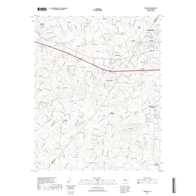
2019 Map of Longview
USGS Topo · Published 2019About this map
The boundary of Burke and Catawba Counties defines this landscape of the western Piedmont, where the industrial and transport corridor of I-40 and Us HWY 70 connects a string of mill towns and crossroads. The city of Hickory and its neighbor Longview anchor the northeastern portion of the map, while smaller communities like Icard, Hildebran, and Henry River line the established road and rail networks. To the north, Rhodhiss sits along the river, and the Hickory Regional Airport occupies the high ground near Penelope. The southern reaches transition into more fragmented terrain, marked by isolated peaks such as Baker Mtn and Piney Mtn. Local heritage is anchored by sites like Burke Chapel United Methodist Church and the Brookford Cemetery, while the waters of Henry Fork and Jacob Fork drain the winding valleys toward the Catawba River basin.
Find a feature on this map
31 named features on this map. Tap any name to fly to it.
Don’t see what you’re looking for? This feature index may not catch every label — zoom into the map to look around manually.
Map Details
Editions of this 2019 Longview Map
This is the sole edition of this map. No revisions or reprints were ever made.
Other maps of this area

1895 · Hickory
USGS Topo · 1:125,000

1905 · Morganton
USGS Topo · 1:125,000

1953 · Charlotte
USGS Topo · 1:250,000

1954 · Charlotte
USGS Topo · 1:250,000

1956 · Valdese
USGS Topo · 1:24,000

1956 · Casar
USGS Topo · 1:24,000

1956 · Drexel
USGS Topo · 1:24,000

1956 · Lenoir
USGS Topo · 1:62,500

1960 · Charlotte
USGS Topo · 1:250,000

1962 · Charlotte
USGS Topo · 1:250,000