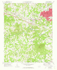
1970 Map of Longview
USGS Topo · Published 1973About this map
Longview and the surrounding borderlands of Burke and Catawba Counties show a landscape of growing towns and established rural crossroads during the early 1970s. The northern corridor is defined by the Southern Railroad line, which connects the industrial and municipal centers of Icard, Hildebran, and Penelope. This area exhibits a dense concentration of civic infrastructure, including the Municipal Airport, City Hall, and the Hickory Recreation Center.
Find a feature on this map
46 named features on this map. Tap any name to fly to it.
Don’t see what you’re looking for? This feature index may not catch every label — zoom into the map to look around manually.
Map Details
Editions of this 1970 Longview Map
This is the sole edition of this map. No revisions or reprints were ever made.
Other maps of this area

1895 · Hickory
USGS Topo · 1:125,000

1905 · Morganton
USGS Topo · 1:125,000

1953 · Charlotte
USGS Topo · 1:250,000

1954 · Charlotte
USGS Topo · 1:250,000

1956 · Valdese
USGS Topo · 1:24,000

1956 · Casar
USGS Topo · 1:24,000

1956 · Drexel
USGS Topo · 1:24,000

1956 · Lenoir
USGS Topo · 1:62,500

1960 · Charlotte
USGS Topo · 1:250,000

1962 · Charlotte
USGS Topo · 1:250,000