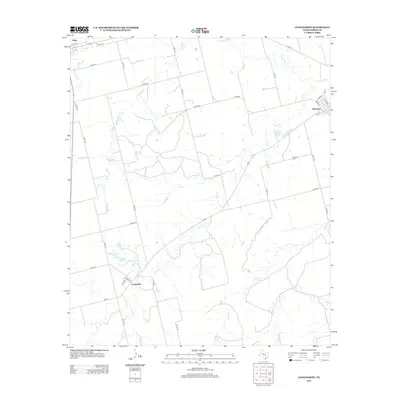
2012 Map of Longworth
USGS Topo · Published 2012About this map
Roby and the surrounding rangelands of Fisher County are defined by a network of ephemeral watercourses and section roads in this early 21st-century landscape. The small settlements of Sylvester and Longworth anchor the agricultural and ranching district, connected by Farm-to-Market roads like FM-1085 and FM-57. Water management and drainage are evident through the paths of Clear Fork, Sandy Cr, and the branching tributaries of China Cr, which carve through the plains. Local history is anchored at the Sylvester Cem located south of the namesake community. The map reveals a highly structured grid of county roads, such as Co RD-108 and Co RD-113, reflecting the enduring land divisions of west-central Texas and the sparse, purposeful distribution of rural homesteads and farm infrastructure across the Rolling Plains.
Find a feature on this map
40 named features on this map. Tap any name to fly to it.
Don’t see what you’re looking for? This feature index may not catch every label — zoom into the map to look around manually.
Map Details
Editions of this 2012 Longworth Map
This is the sole edition of this map. No revisions or reprints were ever made.
Other maps of this area

1893 · Roby
USGS Topo · 1:125,000

1931 · Rotan
USGS Topo · 1:62,500

1954 · Big Spring
USGS Topo · 1:250,000

1957 · Noodle
USGS Topo · 1:62,500

1958 · Big Spring
USGS Topo · 1:250,000

1965 · McCaulley
USGS Topo · 1:24,000

1969 · Rotan
USGS Topo · 1:24,000

1969 · Busby
USGS Topo · 1:24,000
1969 · Roby
USGS Topo · 1:24,000

1969 · Eskota
USGS Topo · 1:24,000