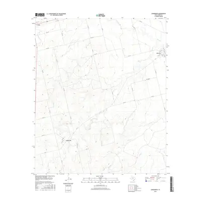
2016 Map of Longworth
USGS Topo · Published 2016About this map
Longworth and Sylvester anchor this rural landscape in the Texas panhandle region, where the terrain is defined by a dendritic network of creek beds. The northern portion of the map is dominated by the Clear Fork of the Brazos River and its tributaries, including Sandy Cr and Cottonwood Cr, which carve through the plains near the town of Roby. To the south, the landscape becomes increasingly textured around the drainage basins of Plum Cr and China Cr. A single dedicated burial ground, Sylvester Cem, is located south of its namesake settlement, serving as a primary point of interest for genealogists tracking family history in this part of Fisher County. The area’s character is primarily agricultural, with a dense grid of county roads such as Co Rd 106 and Co Rd 152 connecting remote homesteads to the small community centers.
Find a feature on this map
39 named features on this map. Tap any name to fly to it.
Don’t see what you’re looking for? This feature index may not catch every label — zoom into the map to look around manually.
Map Details
Editions of this 2016 Longworth Map
This is the sole edition of this map. No revisions or reprints were ever made.
Other maps of this area

1893 · Roby
USGS Topo · 1:125,000

1931 · Rotan
USGS Topo · 1:62,500

1954 · Big Spring
USGS Topo · 1:250,000

1957 · Noodle
USGS Topo · 1:62,500

1958 · Big Spring
USGS Topo · 1:250,000

1965 · McCaulley
USGS Topo · 1:24,000

1969 · Rotan
USGS Topo · 1:24,000

1969 · Busby
USGS Topo · 1:24,000
1969 · Roby
USGS Topo · 1:24,000

1969 · Eskota
USGS Topo · 1:24,000