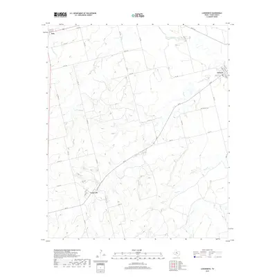
2019 Map of Longworth
USGS Topo · Published 2019About this map
Longworth and the surrounding ranchlands of Fisher County are defined by an intricate network of seasonal waterways and rural roads. The landscape is dominated by the drainage basins of China Cr, Plum Cr, and Sandy Cr, all of which feed toward the Clear Fork Brazos River in the northern portion of the map. While the settlement at Longworth serves as a central point along FM 57, the community of Sylvester at the northeastern corner provides a glimpse into the regional road network near Moore Ave. This modern survey illustrates the sparse but persistent settlement pattern of West Texas, where the Sylvester Cem stands as a focal point for local family history and genealogy. The topography transitions from the river bottomlands to the higher ground near Roby, connected by numerous county roads like Co RD 106 that lace through the breaks and plains.
Find a feature on this map
37 named features on this map. Tap any name to fly to it.
Don’t see what you’re looking for? This feature index may not catch every label — zoom into the map to look around manually.
Map Details
Editions of this 2019 Longworth Map
This is the sole edition of this map. No revisions or reprints were ever made.
Other maps of this area

1893 · Roby
USGS Topo · 1:125,000

1931 · Rotan
USGS Topo · 1:62,500

1954 · Big Spring
USGS Topo · 1:250,000

1957 · Noodle
USGS Topo · 1:62,500

1958 · Big Spring
USGS Topo · 1:250,000

1965 · McCaulley
USGS Topo · 1:24,000

1969 · Rotan
USGS Topo · 1:24,000

1969 · Busby
USGS Topo · 1:24,000
1969 · Roby
USGS Topo · 1:24,000

1969 · Eskota
USGS Topo · 1:24,000