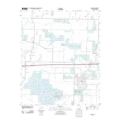
2011 Map of Lonoke
USGS Topo · Published 2011About this map
Lonoke serves as the primary hub of this Arkansas landscape, characterized by the winding paths of Bayou Two Prairie and Bayou Meto. The map documents a blend of established town grids and agricultural infrastructure, notably the Hogan State Fish Hatchery south of the main settlement. For genealogists, the map provides precise locations for several regional burial grounds, including Hester Cemetery and Beard Cemetery in the north, and Brownsville Cemetery to the east. Smaller communities like Furlow, Brownsville, and Meto are connected by a network of local roads such as Gentry Rd and Tull Rd. The drainage patterns shown by White Oak Branch and Bakers Bayou illustrate the hydrological management essential to this low-lying prairie region, reflecting the area's continued reliance on its water resources for both industry and local utility during the early 21st century.
Find a feature on this map
78 named features on this map. Tap any name to fly to it.
Don’t see what you’re looking for? This feature index may not catch every label — zoom into the map to look around manually.
Map Details
Editions of this 2011 Lonoke Map
This is the sole edition of this map. No revisions or reprints were ever made.
Other maps of this area

1891 · Little Rock
USGS Topo · 1:125,000

1893 · Little Rock
USGS Topo · 1:125,000

1937 · England
USGS Topo · 1:48,000

1940 · Lonoke
USGS Topo · 1:62,500

1941 · Cabot
USGS Topo · 1:31,680

1942 · Scott
USGS Topo · 1:31,680

1943 · England
USGS Topo · 1:62,500

1943 · Jacksonville
USGS Topo · 1:31,680

1948 · Helena
USGS Topo · 1:250,000

1949 · Lonoke
USGS Topo · 1:62,500