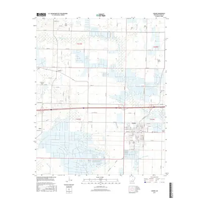
2017 Map of Lonoke
USGS Topo · Published 2017About this map
Lonoke serves as the central hub of this Arkansas landscape, where the rectilinear street grid of the town center contrasts with the agricultural patterns of the Grand Prairie. This survey captures the region's reliance on both aviation and land transport, featuring Bully Henry Airport to the north and Country Air Estates Airport near Furlow. The area is defined by the winding paths of Bayou Two Prairie and Bayou Meto, which carve through the organized sections and ranges.
Find a feature on this map
103 named features on this map. Tap any name to fly to it.
Don’t see what you’re looking for? This feature index may not catch every label — zoom into the map to look around manually.
Map Details
Editions of this 2017 Lonoke Map
This is the sole edition of this map. No revisions or reprints were ever made.
Other maps of this area

1891 · Little Rock
USGS Topo · 1:125,000

1893 · Little Rock
USGS Topo · 1:125,000

1937 · England
USGS Topo · 1:48,000

1940 · Lonoke
USGS Topo · 1:62,500

1941 · Cabot
USGS Topo · 1:31,680

1942 · Scott
USGS Topo · 1:31,680

1943 · England
USGS Topo · 1:62,500

1943 · Jacksonville
USGS Topo · 1:31,680

1948 · Helena
USGS Topo · 1:250,000

1949 · Lonoke
USGS Topo · 1:62,500