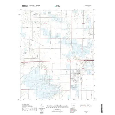
2020 Map of Lonoke
USGS Topo · Published 2020About this map
Lonoke serves as the focal point of this Arkansas landscape, where the Lonoke County Courthouse anchors a grid of streets at the intersection of local commerce and government. The surrounding terrain of the Grand Prairie is defined by an extensive network of drainage and agricultural divisions, reflecting the region's deep ties to rice farming and prairie ecology. Waterways like Bayou Two Prairie and Bayou Meto snake through the fields, providing natural boundaries for the outlying settlements of Furlow and Meto. Small family and community landmarks are scattered throughout the rural sections, including Beard Cem and Hester Cem, which offer significant value for genealogical research in Lonoke County. The area’s modern character is further shaped by aviation hubs such as Bully Henry Airport and Country Air Estates Airport, which illustrate the integration of local transport within the traditional farming landscape.
Find a feature on this map
71 named features on this map. Tap any name to fly to it.
Don’t see what you’re looking for? This feature index may not catch every label — zoom into the map to look around manually.
Map Details
Editions of this 2020 Lonoke Map
This is the sole edition of this map. No revisions or reprints were ever made.
Other maps of this area

1891 · Little Rock
USGS Topo · 1:125,000

1893 · Little Rock
USGS Topo · 1:125,000

1937 · England
USGS Topo · 1:48,000

1940 · Lonoke
USGS Topo · 1:62,500

1941 · Cabot
USGS Topo · 1:31,680

1942 · Scott
USGS Topo · 1:31,680

1943 · England
USGS Topo · 1:62,500

1943 · Jacksonville
USGS Topo · 1:31,680

1948 · Helena
USGS Topo · 1:250,000

1949 · Lonoke
USGS Topo · 1:62,500