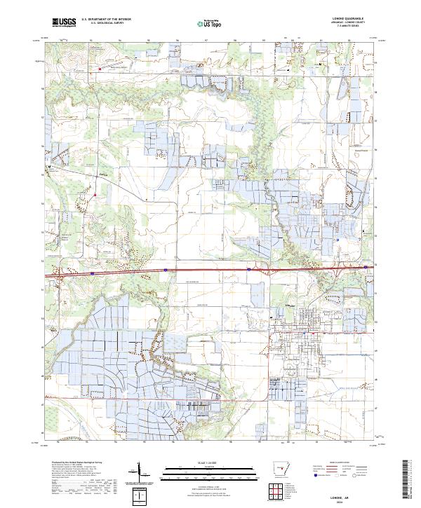
2024 Map of Lonoke
USGS Topo · Published 2024About this map
The Lonoke County Courthouse serves as the focal point for this section of Central Arkansas, where the agricultural landscape of the Grand Prairie meets the intricate waterways of the Delta. The settlement of Lonoke is characterized by a dense grid of streets and municipal infrastructure, flanked by smaller communities like Furlow and Meto. The terrain is defined by the winding courses of Bayou Two Prairie and Bayou Meto, which weave through a patchwork of rice fields and timber stands. Rural life is anchored by family and community landmarks, including Hester Cem, Burris Branch Cem, and Brownsville Cem. Aviation also marks the region, with the Bully Henry Airport and Country Air Estates Airport providing local air access amidst the vast drainage networks of Baker Bayou and White Oak Branch.
Find a feature on this map
89 named features on this map. Tap any name to fly to it.
Don’t see what you’re looking for? This feature index may not catch every label — zoom into the map to look around manually.
Map Details
Editions of this 2024 Lonoke Map
This is the sole edition of this map. No revisions or reprints were ever made.
Other maps of this area

1891 · Little Rock
USGS Topo · 1:125,000

1893 · Little Rock
USGS Topo · 1:125,000

1937 · England
USGS Topo · 1:48,000

1940 · Lonoke
USGS Topo · 1:62,500

1941 · Cabot
USGS Topo · 1:31,680

1942 · Scott
USGS Topo · 1:31,680

1943 · England
USGS Topo · 1:62,500

1943 · Jacksonville
USGS Topo · 1:31,680

1948 · Helena
USGS Topo · 1:250,000

1949 · Lonoke
USGS Topo · 1:62,500