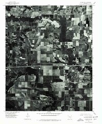
1975 Map of Lonoke SW
USGS Topo · Published 1977About this map
Agricultural fields and geometric drainage patterns define this mid-1970s orthophotograph of the Arkansas delta region. The city of Lonoke stands as the primary population center, showing its residential grid and industrial footprints clearly against the surrounding rural landscape. To the northwest, the smaller settlement of Furlow marks a secondary point of habitation amidst the sprawling acreage. Water management is a visible priority across the terrain, with features like Baker and Bayou integrated into a complex system of straightened channels and rectangular reservoirs. The imagery, captured by the Geological Survey, reveals the highly organized nature of late 20th-century farming, where natural contours have been replaced by the precise lines of modern land use.
Find a feature on this map
4 named features on this map. Tap any name to fly to it.
Don’t see what you’re looking for? This feature index may not catch every label — zoom into the map to look around manually.
Map Details
Editions of this 1975 Lonoke SW Map
This is the sole edition of this map. No revisions or reprints were ever made.
Other maps of this area

1891 · Little Rock
USGS Topo · 1:125,000

1893 · Little Rock
USGS Topo · 1:125,000

1937 · England
USGS Topo · 1:48,000

1940 · Lonoke
USGS Topo · 1:62,500

1941 · Cabot
USGS Topo · 1:31,680

1942 · Scott
USGS Topo · 1:31,680

1943 · England
USGS Topo · 1:62,500

1943 · Jacksonville
USGS Topo · 1:31,680

1948 · Helena
USGS Topo · 1:250,000

1949 · Lonoke
USGS Topo · 1:62,500