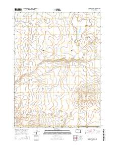
2014 Map of Lookout Lake
USGS Topo · Published 2014About this map
Lookout Lake and the surrounding high desert terrain of southern Malheur County are captured in this 2014 survey. The landscape is defined by its water management and volcanic geography, featuring Airplane Reservoir and the Black Butte Lake Reservoir. High points such as Willow Creek Butte and Mahogany Butte overlook the drainage basins of Toppin Cr and Tent Cr, which carve through the arid plateaus. Remote access to this corner of Oregon is provided by the primitive Airplane Reservoir Rd and Tent Creek Rd, which follow the natural contours and ridges of the area. This map reveals a late-20th-century ranching and resource-management landscape, where named features like McGinnis Ridge point to the area's history of land use and navigation.
Find a feature on this map
18 named features on this map. Tap any name to fly to it.
Don’t see what you’re looking for? This feature index may not catch every label — zoom into the map to look around manually.
Map Details
Editions of this 2014 Lookout Lake Map
This is the sole edition of this map. No revisions or reprints were ever made.
Other maps of this area

1882 · Paradise
USGS Topo · 1:250,000

1893 · Paradise
USGS Topo · 1:250,000

1955 · McDermitt
USGS Topo · 1:250,000

1955 · Jordan Valley
USGS Topo · 1:250,000

1957 · Jordan Valley
USGS Topo · 1:250,000

1958 · Jordan Valley
USGS Topo · 1:250,000

1959 · McDermitt
USGS Topo · 1:250,000

1980 · Calico Butte
USGS Topo · 1:24,000

1980 · Mahogany Spring
USGS Topo · 1:24,000
1980 · Nadine Butte
USGS Topo · 1:24,000