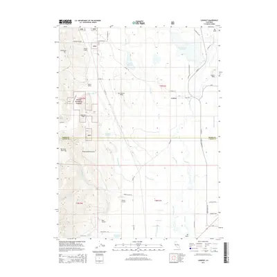
2015 Map of Lookout
USGS Topo · Published 2015About this map
Lookout sits at the intersection of agricultural valley floor and timbered highlands, centered where the Pit River flows through the broad Big Valley. This 2015 survey details the complex water management systems of the region, featuring intricate drainage patterns at Bull Run Slough and Egg Lake Slough alongside several reservoirs like Taylor Reservoir and Kramer Reservoir. To the west, the terrain rises sharply into the Modoc National Forest, marked by the steep relief of the Big Valley Mountains and Jimmerson Mtn. Local infrastructure is anchored by Southard Field and a network of named rural routes, such as Co Road 93 and Bieber Lookout Rd, which connect remote homesteads and springs like Vicker Springs to the settlement. The map also delineates the jurisdictional boundary between Modoc Co and Lassen Co, illustrating how the landscape transitions from the protected forests of Alderman Ridge to the open ranching lands of the valley.
Find a feature on this map
53 named features on this map. Tap any name to fly to it.
Don’t see what you’re looking for? This feature index may not catch every label — zoom into the map to look around manually.
Map Details
Editions of this 2015 Lookout Map
This is the sole edition of this map. No revisions or reprints were ever made.
Other maps of this area

1886 · Modoc Lava Bed
USGS Topo · 1:250,000

1892 · Modoc Lava-Bed
USGS Topo · 1:250,000

1954 · Alturas
USGS Topo · 1:250,000

1958 · Alturas
USGS Topo · 1:250,000

1961 · Bieber
USGS Topo · 1:62,500

1961 · Fall River Mills
USGS Topo · 1:62,500

1962 · Alturas
USGS Topo · 1:250,000

1962 · Crank Mountain
USGS Topo · 1:62,500

1962 · White Horse
USGS Topo · 1:62,500

1965 · Alturas
USGS Topo · 1:250,000