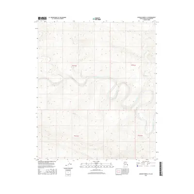
2016 Map of Lookout Ridge A-1 SE
USGS Topo · Published 2016About this map
Awuna River meanders through this remote portion of the North Slope, carving a serpentine path through the Arctic landscape. The river, which dominates the central and eastern sections of the quadrangle, serves as the primary hydrological feature in an area defined by significant relief and traditional land divisions. To the northeast, the smaller tributary Section Cr flows through the township of t4s r17w, illustrating the natural drainage patterns of this high-latitude region. The map reflects the 21st-century state of these public lands, documented with precision by the U.S. Geological Survey and the BLM. While the terrain is uninhabited, the survey provides vital geographical data for the townships of t4s r18w, t5s r18w, and t5s r17w, which are essential for land management and environmental studies in northern Alaska.
Find a feature on this map
6 named features on this map. Tap any name to fly to it.
Don’t see what you’re looking for? This feature index may not catch every label — zoom into the map to look around manually.
Map Details
Editions of this 2016 Lookout Ridge A-1 SE Map
This is the sole edition of this map. No revisions or reprints were ever made.
Other maps of this area

1951 · Lookout Ridge
USGS Topo · 1:250,000

1951 · Ikpikpuk River
USGS Topo · 1:250,000

1951 · Howard Pass
USGS Topo · 1:250,000

1951 · Killik River
USGS Topo · 1:250,000

1956 · Lookout Ridge
USGS Topo · 1:250,000

1956 · Howard Pass
USGS Topo · 1:250,000

1956 · Killik River
USGS Topo · 1:250,000

1956 · Ikpikpuk River
USGS Topo · 1:250,000

1984 · Howard Pass D-1
USGS Topo · 1:63,360

1984 · Killik River D-5
USGS Topo · 1:63,360