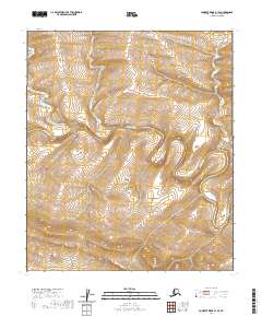
2020 Map of Lookout Ridge A-1 SE
USGS Topo · Published 2020About this map
The Awuna River meanders across this northern landscape in the North Slope Borough, providing the primary hydrological throughway in a region of significant topographic relief. In the upper right quadrant, Section Cr drains into the larger river system, tracing a path through the remote tundra. This survey documents the specific township and range boundaries including t4s r18w and t5s r17w, reflecting the formal cadastral organization used to manage these arctic territories. The contour patterns reveal a series of ridges and valleys that define the watershed of the Awuna River, illustrating the natural drainage complexity of the Alaskan interior before any significant infrastructure development.
Find a feature on this map
6 named features on this map. Tap any name to fly to it.
Don’t see what you’re looking for? This feature index may not catch every label — zoom into the map to look around manually.
Map Details
Editions of this 2020 Lookout Ridge A-1 SE Map
This is the sole edition of this map. No revisions or reprints were ever made.
Other maps of this area

1951 · Lookout Ridge
USGS Topo · 1:250,000

1951 · Ikpikpuk River
USGS Topo · 1:250,000

1951 · Howard Pass
USGS Topo · 1:250,000

1951 · Killik River
USGS Topo · 1:250,000

1956 · Lookout Ridge
USGS Topo · 1:250,000

1956 · Howard Pass
USGS Topo · 1:250,000

1956 · Killik River
USGS Topo · 1:250,000

1956 · Ikpikpuk River
USGS Topo · 1:250,000

1984 · Howard Pass D-1
USGS Topo · 1:63,360

1984 · Killik River D-5
USGS Topo · 1:63,360