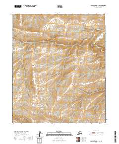
2020 Map of Lookout Ridge B-1 SW
USGS Topo · Published 2020About this map
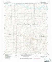
The Kigalik River meanders across this uninhabited stretch of the North Slope, illustrating the braided hydrology characteristic of the Alaskan tundra. This 2020 USGS survey documents the terrain within the t1s r19w, t1s r18w, t2s r19w, and t2s r18w township boundaries. The landscape is defined by its lack of human infrastructure, focusing instead on the subtle elevation changes and watercourses of the arctic coastal plain. Geologists and environmental researchers can use this data to examine natural drainage patterns and topographical shifts in a region largely untouched by development. The map serves as a contemporary baseline for the physical geography of the Lookout Ridge B-1 SW quadrangle.
Find a feature on this map
5 named features on this map. Tap any name to fly to it.
Don’t see what you’re looking for? This feature index may not catch every label — zoom into the map to look around manually.
Map Details
Editions of this 2020 Lookout Ridge B-1 SW Map
This is the sole edition of this map. No revisions or reprints were ever made.
Other maps of this area

1951 · Lookout Ridge
USGS Topo · 1:250,000

1956 · Lookout Ridge
USGS Topo · 1:250,000
1984 · Lookout Ridge A-1
USGS Topo · 1:63,360
1984 · Lookout Ridge A-2
USGS Topo · 1:63,360
1985 · Lookout Ridge B-2
USGS Topo · 1:63,360
1985 · Lookout Ridge B-1
USGS Topo · 1:63,360
2016 · Lookout Ridge B-2 SE
USGS Topo · 1:25,000
2016 · Lookout Ridge B-1 NE
USGS Topo · 1:25,000

2016 · Lookout Ridge A-1 NE
USGS Topo · 1:25,000
2016 · Lookout Ridge B-2 NE
USGS Topo · 1:25,000