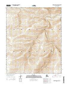
2014 Map of Lookout Ridge C-5 SW
USGS Topo · Published 2014About this map
Shaningarok Cr winds through the northern reaches of the Alaska North Slope, providing the primary drainage for this remote landscape within the T3n R28w and T2n R28w township boundaries. The terrain is characterized by a high-density drainage network typical of the Brooks Range foothills, where seasonal runoff carves deep into the tundra surface. This 2014 survey captures the untouched topography of the region before significant contemporary industrial expansion, highlighting the natural flow of the water system toward the Arctic coast. The map is structured by the Public Land Survey System, showing the intersection of T3n R29w and T2n R29w, providing a precise record of the land divisions in this uninhabited section of the Lookout Ridge quadrangle.
Find a feature on this map
41 named features on this map. Tap any name to fly to it.
Don’t see what you’re looking for? This feature index may not catch every label — zoom into the map to look around manually.
Map Details
Editions of this 2014 Lookout Ridge C-5 SW Map
This is the sole edition of this map. No revisions or reprints were ever made.
Other maps of this area

1951 · Utukok River
USGS Topo · 1:250,000

1951 · Lookout Ridge
USGS Topo · 1:250,000

1956 · Lookout Ridge
USGS Topo · 1:250,000

1956 · Utukok River
USGS Topo · 1:250,000

1965 · Utukok River
USGS Topo · 1:250,000
1984 · Lookout Ridge C-5
USGS Topo · 1:63,360
1984 · Utukok River C-1
USGS Topo · 1:63,360
1985 · Lookout Ridge B-5
USGS Topo · 1:63,360
1985 · Utukok River B-1
USGS Topo · 1:63,360
2014 · Utukok River B-1 NE
USGS Topo · 1:25,000