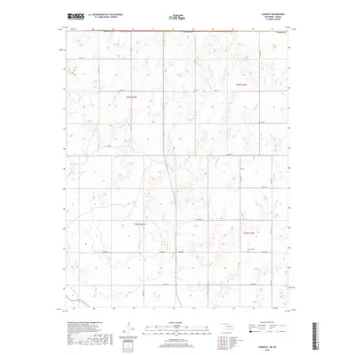
2018 Map of Lookout
USGS Topo · Published 2018About this map
The Cimarron River winds through the southern edge of this landscape in Harper County, carving a wide valley that defines the local geography. North of the river, the small settlement of Lookout serves as a central point for a rural community structured by an extensive grid of section-line roads, including Kiowa Rd and Latimer Rd. The land is deeply dissected by drainage systems like Keno Cr and Day Cr, which flow south toward the Cimarron basin.
Find a feature on this map
30 named features on this map. Tap any name to fly to it.
Don’t see what you’re looking for? This feature index may not catch every label — zoom into the map to look around manually.
Map Details
Editions of this 2018 Lookout Map
This is the sole edition of this map. No revisions or reprints were ever made.
Other maps of this area

1892 · Coldwater
USGS Topo · 1:125,000

1955 · Woodward
USGS Topo · 1:250,000

1955 · Pratt
USGS Topo · 1:250,000

1958 · Woodward
USGS Topo · 1:250,000

1959 · Pratt
USGS Topo · 1:250,000

1970 · Lookout
USGS Topo · 1:24,000

1970 · Freedom NW
USGS Topo · 1:24,000

1970 · Edith
USGS Topo · 1:24,000

1970 · Selman NW
USGS Topo · 1:24,000

1971 · Selman SE
USGS Topo · 1:24,000