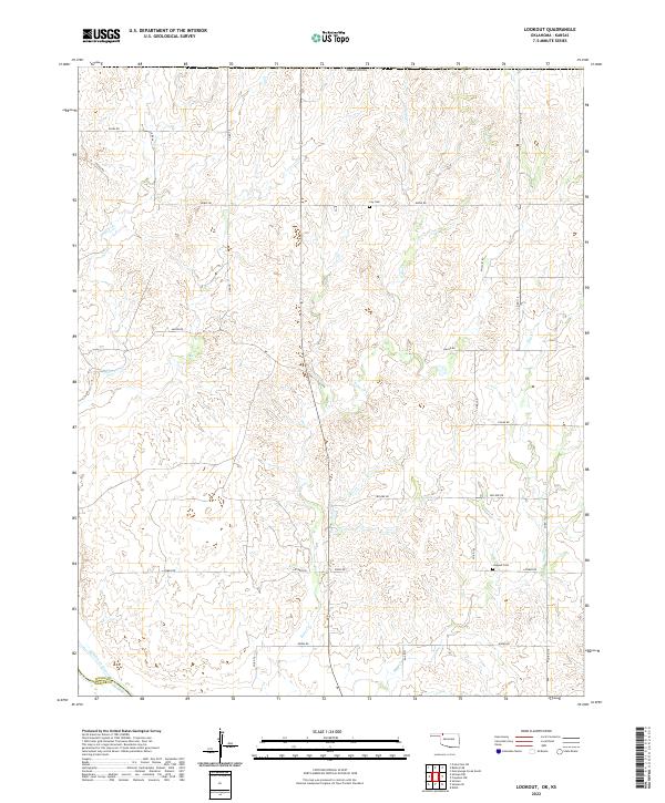
2022 Map of Lookout
USGS Topo · Published 2022About this map
Cimarron River winds through the southwestern corner of this Northwest Oklahoma landscape, marking a transition between the open plains and the drainage systems of Keno Cr and Day Cr. This modern survey reveals a highly structured rural grid, where section lines are defined by long-established thoroughfares such as Osage Rd and Kiowa Rd. The map illustrates a sparse settlement pattern characteristic of the high plains, where human presence is anchored by local history markers like Lookout Cem and Coy Cem. Along the western edge, the Woods Co Harper Co line cuts through the terrain, highlighting the administrative boundaries that have shaped land ownership in this region. The network of named roads, including Latimer Rd and LeFlore Rd, provides a clear view of the modern infrastructure serving the scattered farmsteads and agricultural plots that dominate the prairie.
Find a feature on this map
29 named features on this map. Tap any name to fly to it.
Don’t see what you’re looking for? This feature index may not catch every label — zoom into the map to look around manually.
Map Details
Editions of this 2022 Lookout Map
This is the sole edition of this map. No revisions or reprints were ever made.
Other maps of this area

1892 · Coldwater
USGS Topo · 1:125,000

1955 · Woodward
USGS Topo · 1:250,000

1955 · Pratt
USGS Topo · 1:250,000

1958 · Woodward
USGS Topo · 1:250,000

1959 · Pratt
USGS Topo · 1:250,000

1970 · Lookout
USGS Topo · 1:24,000

1970 · Freedom NW
USGS Topo · 1:24,000

1970 · Edith
USGS Topo · 1:24,000

1970 · Selman NW
USGS Topo · 1:24,000

1971 · Selman SE
USGS Topo · 1:24,000