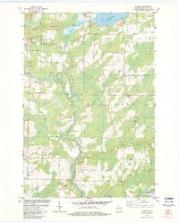
1982 Map of Loomis
USGS Topo · Published 1983About this map
The Peshtigo River carves a winding path through this northern Wisconsin landscape, anchoring a region defined by its timber-era roots and recreational waters. The settlement of Crivitz stands at a significant crossroads, where the Chicago Milwaukee St Paul and Pacific railroad intersects with local travel routes like South Street. This rail corridor was essential to the local economy, facilitating the movement of materials from numerous Gravel Pits and a Quarry scattered across the townships of Stephenson and Beaver.
Find a feature on this map
40 named features on this map. Tap any name to fly to it.
Don’t see what you’re looking for? This feature index may not catch every label — zoom into the map to look around manually.
Map Details
Editions of this 1982 Loomis Map
This is the sole edition of this map. No revisions or reprints were ever made.
Other maps of this area

1939 · Porterfield
USGS Topo · 1:48,000

1940 · Athelstane
USGS Topo · 1:48,000

1941 · Coleman
USGS Topo · 1:48,000

1942 · Athelstane
USGS Topo · 1:48,000

1942 · Coleman
USGS Topo · 1:48,000

1942 · Porterfield
USGS Topo · 1:48,000

1942 · Wausaukee
USGS Topo · 1:48,000

1947 · Wausaukee
USGS Topo · 1:48,000

1950 · Coleman
USGS Topo · 1:48,000

1954 · Iron Mountain
USGS Topo · 1:250,000