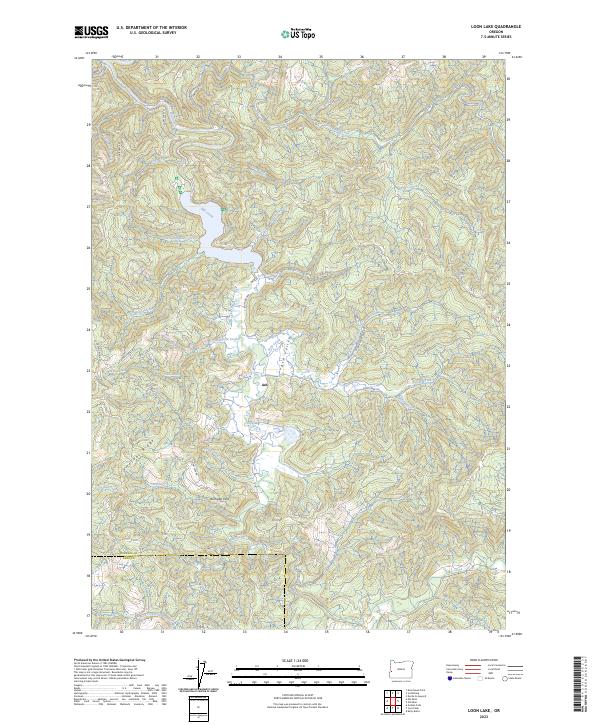
2023 Map of Loon Lake
USGS Topo · Published 2023About this map
Ash sits at the center of this landscape in the Ash Valley, representing a pocket of settlement within the heavily forested terrain of the Oregon Coast Range. The map illustrates a complex drainage network where Mill Creek and Soup Creek carve through the deep ridges, eventually feeding the prominent water body accessed via Loon Lake Rd. The convergence of Tipton Creek, Tom Fool Creek, and Bickford Creek into the larger valley system shows a classic Pacific Northwest watershed pattern, dominated by steep timberlands and narrow creek bottoms.
Find a feature on this map
41 named features on this map. Tap any name to fly to it.
Don’t see what you’re looking for? This feature index may not catch every label — zoom into the map to look around manually.
Map Details
Editions of this 2023 Loon Lake Map
This is the sole edition of this map. No revisions or reprints were ever made.
Other maps of this area

1928 · Sitkum
USGS Topo · 1:125,000

1955 · Scottsburg
USGS Topo · 1:62,500

1955 · Ivers Peak
USGS Topo · 1:62,500

1955 · Tyee
USGS Topo · 1:62,500

1955 · Elkton
USGS Topo · 1:62,500

1958 · Roseburg
USGS Topo · 1:250,000

1959 · Roseburg
USGS Topo · 1:250,000

1979 · Roseburg
USGS Topo · 1:100,000

1979 · Cottage Grove
USGS Topo · 1:100,000
1985 · Loon Lake
USGS Topo · 1:24,000