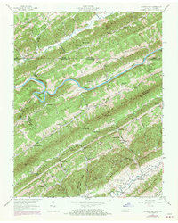
1947 Map of Looneys Gap
USGS Topo · Published 1970About this map
Clinch Mountain and Copper Ridge dominate this corner of the Appalachian Valley, creating a landscape of alternating high ridges and narrow agricultural bottoms along the Clinch River. The map highlights the traditional river-and-ridge lifestyle of the mid-20th century, where travel was dictated by breaks in the terrain like Looneys Gap and river crossings such as Horton Ford. Small, localized communities are centered around institutions like the Wake Forest School, Daugherty Chapel, and the County Farm near Gravelly Valley.
Find a feature on this map
131 named features on this map. Tap any name to fly to it.
Don’t see what you’re looking for? This feature index may not catch every label — zoom into the map to look around manually.
Map Details
Editions of this 1947 Looneys Gap Map
This is the sole edition of this map. No revisions or reprints were ever made.
Other maps of this area

1883 · Morristown
USGS Topo · 1:125,000

1887 · Jonesville
USGS Topo · 1:125,000

1891 · Jonesville
USGS Topo · 1:125,000

1892 · Greeneville
USGS Topo · 1:125,000

1893 · Morristown
USGS Topo · 1:125,000

1894 · Estillville
USGS Topo · 1:125,000

1895 · Morristown
USGS Topo · 1:125,000

1896 · Greeneville
USGS Topo · 1:125,000

1904 · Greeneville
USGS Topo · 1:125,000

1935 · Surgoinsville
USGS Topo · 1:48,000