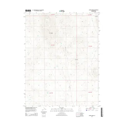
2014 Map of Lopers Spring
USGS Topo · Published 2014About this map
The Mountain Home Range dominates this portion of Beaver County, where high-elevation desert terrain is defined by a critical network of water sources. The presence of Lopers Spring, Garnet Spring, and Cougar Spring suggests the essential nature of these points for livestock and wildlife in an otherwise arid landscape. Moving south, a series of seepages including North Sulphur Spring and South Sulphur Spring drain toward the lower elevations. The map reveals a land utilized for range, connected by the solitary Lopers Spring Rd which winds through Spike Hollow. Notable topographic landmarks such as The Needles and Cottonwood Wash provide distinct navigational points for those retracing historical grazing routes or surveying the interior of the Great Basin.
Find a feature on this map
20 named features on this map. Tap any name to fly to it.
Don’t see what you’re looking for? This feature index may not catch every label — zoom into the map to look around manually.
Map Details
Editions of this 2014 Lopers Spring Map
This is the sole edition of this map. No revisions or reprints were ever made.
Other maps of this area

1953 · Richfield
USGS Topo · 1:250,000

1956 · Lund
USGS Topo · 1:250,000

1958 · Richfield
USGS Topo · 1:250,000

1960 · Lund
USGS Topo · 1:250,000

1971 · Mountain Home Pass
USGS Topo · 1:24,000

1971 · Halfway Summit
USGS Topo · 1:24,000

1971 · Sawtooth Peak
USGS Topo · 1:24,000

1972 · Gleason Basin
USGS Topo · 1:24,000

1972 · Hamlin Well
USGS Topo · 1:24,000

1972 · Miller Wash
USGS Topo · 1:24,000