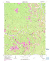
1968 Map of Lorado
USGS Topo · Published 1989About this map
Lorado and the surrounding coal camps of the Buffalo Creek valley appear here as they were during the late 1960s, a period marked by extensive industrial activity and mountain-top modification. This West Virginia landscape is defined by the heavy footprint of the mining industry, with numerous Strip Mines, Mine Dumps, and Tailings Ponds concentrated along the ridges of Spring Mountain and Crook Mountain. The settlement pattern follows the narrow valley floors, where the Buffalo Creek drainage supports tight-knit communities like Pardee, Saunders, and Craneco.
Find a feature on this map
57 named features on this map. Tap any name to fly to it.
Don’t see what you’re looking for? This feature index may not catch every label — zoom into the map to look around manually.
Map Details
Editions of this 1968 Lorado Map
Other maps of this area

1891 · Oceana
USGS Topo · 1:125,000

1893 · Oceana
USGS Topo · 1:125,000

1898 · Oceana
USGS Topo · 1:125,000

1909 · Gilbert
USGS Topo · 1:48,000

1910 · Pineville
USGS Topo · 1:48,000

1910 · Bald Knob
USGS Topo · 1:48,000

1912 · Bald Knob
USGS Topo · 1:62,500

1912 · Gilbert
USGS Topo · 1:62,500

1912 · Pineville
USGS Topo · 1:62,500

1913 · Logan
USGS Topo · 1:62,500