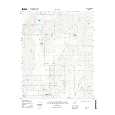
2014 Map of Lorado
USGS Topo · Published 2014About this map
Crowleys Ridge rises through the center of this landscape, a distinctive geological landform that separates the lowlands of the Mississippi Alluvial Plain. The map documents a dense network of rural infrastructure along the Greene and Craighead county line, anchored by historic communities like Lorado and Herndon. These settlements are marked by numerous small cemeteries, including Lorado Cem and Philadelphia Cem, which serve as vital markers for genealogical research in this part of Northeast Arkansas.
Find a feature on this map
162 named features on this map. Tap any name to fly to it.
Don’t see what you’re looking for? This feature index may not catch every label — zoom into the map to look around manually.
Map Details
Editions of this 2014 Lorado Map
This is the sole edition of this map. No revisions or reprints were ever made.
Other maps of this area

1932 · Walnut Ridge
USGS Topo · 1:62,500

1935 · Sedgwick
USGS Topo · 1:62,500

1935 · Walnut Ridge
USGS Topo · 1:62,500

1939 · Jonesboro
USGS Topo · 1:62,500

1940 · Gainesville
USGS Topo · 1:62,500

1953 · Memphis
USGS Topo · 1:250,000

1956 · Memphis
USGS Topo · 1:250,000

1957 · Poplar Bluff
USGS Topo · 1:250,000

1958 · Jonesboro
USGS Topo · 1:62,500

1958 · Gainesville
USGS Topo · 1:62,500