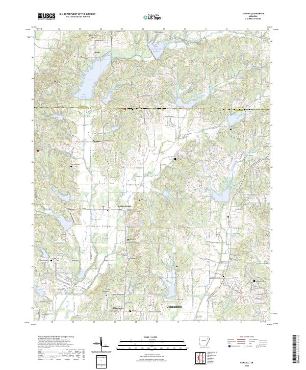
2024 Map of Lorado
USGS Topo · Published 2024About this map
Crowleys Ridge defines the topography of this region north of Jonesboro, where the boundary between Greene Co and Craighead Co cuts through a landscape shaped by the waters of Big Creek. This modern survey reveals a network of rural settlements and agricultural crossroads, including Lorado, Herndon, and Sterling Springs. The drainage patterns are heavily modified by a series of flood control structures, most notably the Big Creek Site One Reservoir and the recreational expanse of Lake Frierson.
Find a feature on this map
169 named features on this map. Tap any name to fly to it.
Don’t see what you’re looking for? This feature index may not catch every label — zoom into the map to look around manually.
Map Details
Editions of this 2024 Lorado Map
This is the sole edition of this map. No revisions or reprints were ever made.
Other maps of this area

1932 · Walnut Ridge
USGS Topo · 1:62,500

1935 · Sedgwick
USGS Topo · 1:62,500

1935 · Walnut Ridge
USGS Topo · 1:62,500

1939 · Jonesboro
USGS Topo · 1:62,500

1940 · Gainesville
USGS Topo · 1:62,500

1953 · Memphis
USGS Topo · 1:250,000

1956 · Memphis
USGS Topo · 1:250,000

1957 · Poplar Bluff
USGS Topo · 1:250,000

1958 · Jonesboro
USGS Topo · 1:62,500

1958 · Gainesville
USGS Topo · 1:62,500