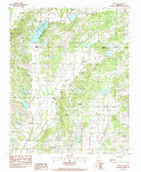
1983 Map of Lorado
USGS Topo · Published 1984About this map
Crowleys Ridge serves as the dominant landform of this northeastern Arkansas landscape, creating a distinct topographic break that separates the alluvial lowlands from the elevated woodland. This 1979 survey captures the rural character of the Greene and Craighead County line, where small agricultural settlements like Lorado and Philadelphia are connected by a web of named secondary roads such as Shiloh Road and New Haven Road.
Find a feature on this map
38 named features on this map. Tap any name to fly to it.
Don’t see what you’re looking for? This feature index may not catch every label — zoom into the map to look around manually.
Map Details
Editions of this 1983 Lorado Map
This is the sole edition of this map. No revisions or reprints were ever made.
Other maps of this area

1932 · Walnut Ridge
USGS Topo · 1:62,500

1935 · Sedgwick
USGS Topo · 1:62,500

1935 · Walnut Ridge
USGS Topo · 1:62,500

1939 · Jonesboro
USGS Topo · 1:62,500

1940 · Gainesville
USGS Topo · 1:62,500

1953 · Memphis
USGS Topo · 1:250,000

1956 · Memphis
USGS Topo · 1:250,000

1957 · Poplar Bluff
USGS Topo · 1:250,000

1958 · Jonesboro
USGS Topo · 1:62,500

1958 · Gainesville
USGS Topo · 1:62,500