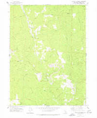
1973 Map of Lord-Ellis Summit
USGS Topo · Published 1977About this map
Redwood Creek defines the rugged verticality of this landscape, winding through a complex network of high ridges and isolated prairies within the Six Rivers National Forest. The map documents a sparsely settled region where human activity is focused on specific points of transport and resource management, such as the Redwood Creek Ranch and the former Camp Anderson (Site). Elevated clearings like Fern Prairie, Christmas Prairie, and Long Prairie stand out as distinct breaks in the dense timberland.
Find a feature on this map
44 named features on this map. Tap any name to fly to it.
Don’t see what you’re looking for? This feature index may not catch every label — zoom into the map to look around manually.
Map Details
Editions of this 1973 Lord-Ellis Summit Map
2 editions found
Other maps of this area

1915 · Big Bar and Vicinity
USGS Topo · 1:250,000

1922 · Korbel
USGS Topo · 1:62,500

1922 · China Flat
USGS Topo · 1:62,500

1925 · Hoopa
USGS Topo · 1:125,000

1945 · Coyote Peak
USGS Topo · 1:62,500

1945 · Blue Lake
USGS Topo · 1:62,500

1948 · Weed
USGS Topo · 1:250,000

1950 · Weed
USGS Topo · 1:250,000

1951 · Blue Lake
USGS Topo · 1:62,500

1952 · Willow Creek
USGS Topo · 1:62,500