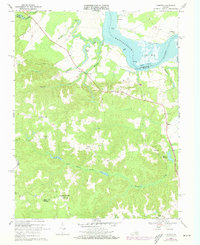
1968 Map of Loretto
USGS Topo · Published 1973About this map
Rappahannock River frontage and interior tidal wetlands define this portion of Essex and Westmoreland Counties during the late 1960s. The landscape is characterized by a series of reaches and points, such as Devils Reach and Ritchie Pt, which historically supported river-based commerce at sites like Saunders Wharf. Inland, the settlement pattern follows the high ground above complex swamp systems, including Black Water Swamp and Occupacia Creek.
Find a feature on this map
37 named features on this map. Tap any name to fly to it.
Don’t see what you’re looking for? This feature index may not catch every label — zoom into the map to look around manually.
Map Details
Editions of this 1968 Loretto Map
4 editions found
Other maps of this area

1889 · Fredericksburg
USGS Topo · 1:125,000

1892 · Fredericksburg
USGS Topo · 1:125,000

1892 · Montross
USGS Topo · 1:62,500

1894 · Fredericksburg
USGS Topo · 1:125,000

1895 · Nomini
USGS Topo · 1:125,000

1895 · Montross
USGS Topo · 1:62,500

1898 · Nomini
USGS Topo · 1:125,000

1918 · Tappahannock
USGS Topo · 1:62,500

1918 · Aylett
USGS Topo · 1:62,500

1919 · Tappahannock
USGS Topo · 1:62,500